CANT’ Ù SEE THE HILL
Europan 17 - Cantù (IT)
Proposal
Year: 2023Team: Luca Luini, Lorenza Sartori, Riccardo Masiero
Location: Cantù, Italy
Status: Lost Competition
The city of Cantù lies on a morainic deposit formed during the advance of the glaciers of the maximum Wurmian expansion: an elevated geographical feature that spans from the Prealps to the vast Po valley. The historic center is naturally grafted onto the highest parts of this hillaccording to a North–South axis. Although Cantù is a medium-sized city (the second for inhabitants in the province), it still enjoys the condition, often absent in other cities in the area, of not being conurbated with other urban centres, surrounded by a green belt that mostly belongs to the Brughiera Briantea Park. This important naturalistic area connects Cantù in form of natural ecological corridors, towards the Prealps to the north through the Spina Verde Park that connects it to the hills of Como. Being in a strategic position between the Prealpine area of Como and the Brianza lakes (with a tourist vocation) and the lower Brianza, fulcrum of a dense production district, the city must make sense of its potential to renew its internal (citizens) and external (tourists) allure. Cantù can be placed at the center of the naturalistic network and of paths, also using the hill as a starting point.

The
hill of Cantù still today remains the recognizable center of the
city: It does not appear as an intact historic village, but it
contains buildings and spaces from very different eras (medieval,
nineteenth-century, and modern), as well as large
private and public green areas,
heritage of the urban villas’ gardens of the past.
The
crest of the hill, which runs North-South, divides the two main
eastern and western suburbsconsisting of mainly mixed residential and industrial areas,
characterizing the most populated portions of the city.
In
recent years, instead of representing a centralizing element, the
hill has mostly represented a
caesura in the city road flows, favoring the centrifugal forcesthat have led to an increasing shift of commercial activities on the
main arteries outside the city (the Canturina road, for example, and
the Canturina Bis, still under planning), to the detriment of the
local trade network to the center. These main automobile road axes
lie in the valley and in themselves constitute a strong boundary
between the city and the natural environments that surround it. The
green and agricultural network close to the center risks finding
itself cut off from these road arteries on which the commercial,
large-scale distribution is increasing.


The center of Cantù and its surrounding environment today constitute a functional puzzle of activities in various areas that can be put into a system to operate this constellation of nodes through new synergies and connections. Not all of these potentials are currently enhanced, but the hill still has internal areas with ample possibilities for regeneration: some sectors such as the De Amicis (for which a PII is envisaged) and the areas behind the Castello di Pietrasanta, once revitalized, will be spring forth a new network of (potentially continuous) city and semi-public green spaces ( a sort of path upon the hills, linked to education and gree anreas) , but also individual abandoned or underused buildings have the potential to enrich the cultural value of the city. Buildings already to be renovated in the FuLaWiM project (Furniture And Lacework Widespread Museum) such as the former church of S. Ambrogio and Villa Calvi, but also the former Lux cinema or the new Palazzo della Permanente Mobili have such spatiality that they will be able to expand the network of cultural offers. Functionally, therefore, one can reason according to a process of reactivation of individual compartmentsand a systemization of the same subjects to create a real diagram of thematic itineraries and interchange areas, which can outline the city center and connect other parts of the city by a functional point of view. The activation strategy of the historic center is grafted according to a relationship between the main social, cultural and economic actors of the city that is both on a physical and a systemic level at the same time, reinforcing the idea of the Cantù hill as a place of cultural, commercial and leisure attraction, and trying to target and highlight the possible hidden itineraries inside the center and which can be propagated outside.
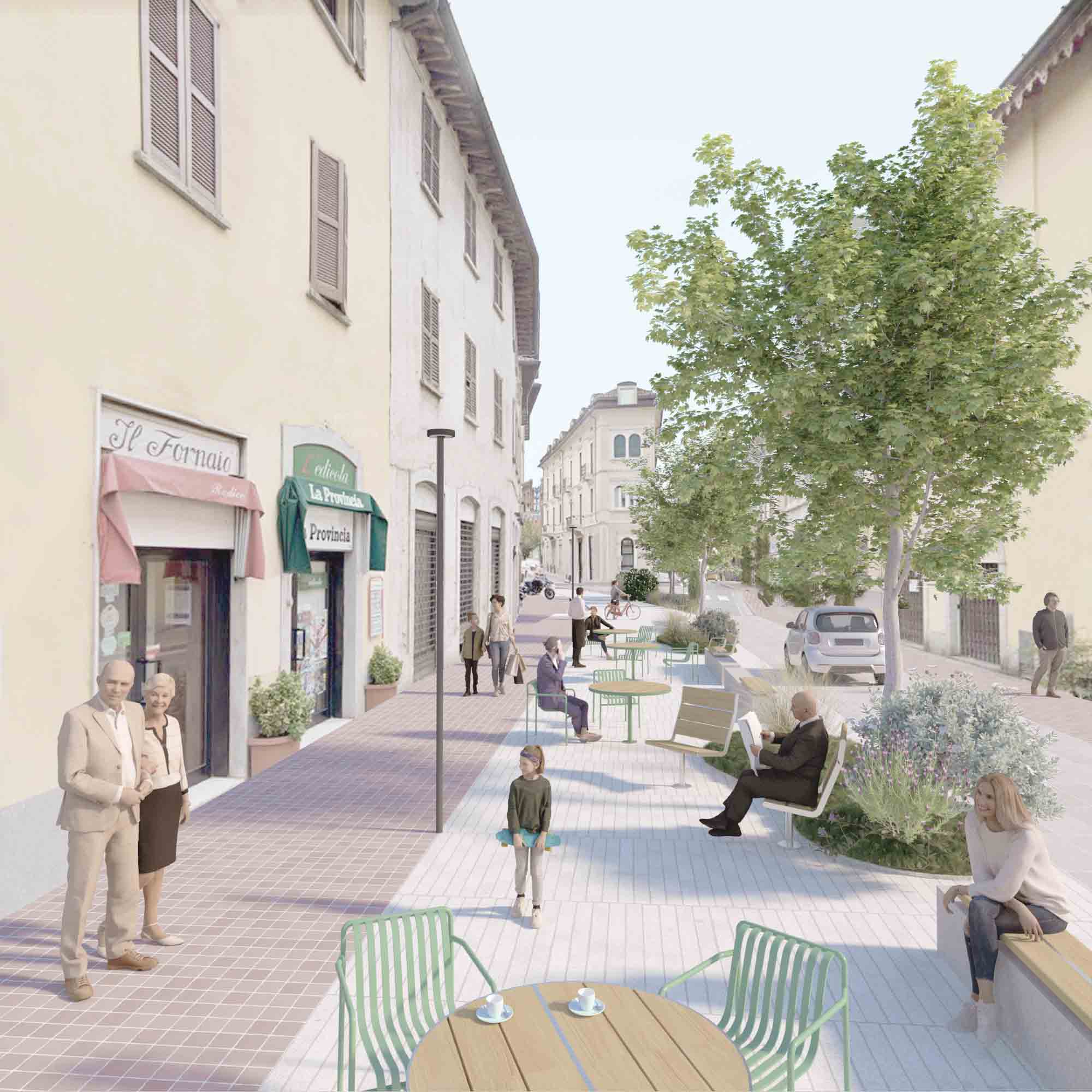
The project of the public space assumes the role of ordering elementof the functional and identifying program of the center, anticipating the activation of the processes of the strategic areas and activating new ones on the social scale. Through a unitary strategy applied to public spaces it is possible to strengthen the identity and cohesion of the center of Cantù. A new system of open spaces connects historic spaces with developing sectors, valued as potential resources for the urban and environmental regeneration of the city. This new system of open spaces favors soft mobility, reinforces the presence of the landscapeas an element of identity and gives new life to some key places in the city. It must interface directly with its surroundings to create an urban reference point that connects public cultural places, paths, green areas and the commercial system of the DUC. The center of Cantù must regain its identity as a living centre, on a human and sustainable scale, in order to give back to the citizens the possibility of reliving forgotten and neglected actions such as walking, stopping, playing, experiencing public space in an intuitive way to favor a peaceful, functional, active coexistence. The center is therefore redesigned with a vision of sequences of active functional spaces, with the intention of reinforcing and mending urban plots that are now unstitched that can intersect existing poles with similar functional vocations to create a pedestrian subway of stops.